September 8, 2022.
The scorching weather of summer 2022 has left much of the Northwestern United States primed to burn with wildland fire. In early September, the northern Rocky Mountains and the Cascade Range billowed with smoke that was slowly wafting across the continental U.S. and southern Canada.
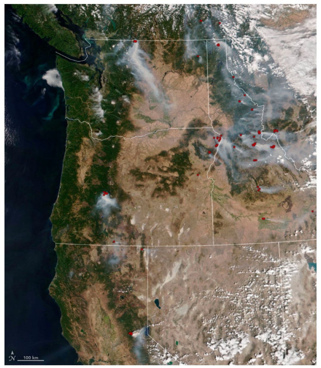
According to the National Interagency Fire Center (NIFC) on September 9, at least 96 large fires were burning on 690,000 acres (2800 square kilometers) in eight states. Many of the fires were clustered in the Northern Rockies, the Great Basin, and the Pacific Northwest, with 37 burning in Idaho, 22 in Montana, 12 apiece in Oregon and Washington, and 10 in California.
The images above and below were acquired by the Visible Infrared Imaging Radiometer Suite (VIIRS) on the NOAA-20 satellite on September 8, 2022. Red pixels indicate areas where VIIRS thermal bands detected high temperatures indicative of fire.

Just northwest of Salmon, Idaho, the Moose Fire has burned more than 125,000 acres (500 square kilometers) since it ignited on July 17, 2022.
The blaze was 33 percent contained on September 9 and not expected to be fully contained until the end of October. Inciweb reported that the fire was caused by human activity, by far the predominant cause of wildland fire in the United States.
In northeastern Oregon, the Double Creek Fire has burned more than 101,000 acres (400 square kilometers) since lightning ignited it on August 30. The fire was 15 percent contained and not expected to be fully contained until the end of October.
The Cedar Creek Fire in Willamette National Forest had been burning since August 1 and consumed 33,000 acres.
“Strong winds will continue in parts of Oregon, Washington, and California. Dry thunderstorms are possible in California and the north central Sierras today,” NIFC reported on September 9.
“Excessive heat warnings remain in effect for much of California and Oregon. A fuels and fire behavior advisory has been issued for northern California due to dry fuels and the potential for extreme fire behavior with the hot, dry, and windy weather pattern.”

This natural-color image shows smoke from the western fires settling over the Black Hills and northern plains on September 7, 2022. The image was acquired by the Moderate Resolution Imaging Spectroradiometer (MODIS) on NASA’s Terra satellite.
The smoky skies should make for spectacular sunrises and sunsets, but they are also degrading air quality with a “campfire” smell and small particulates that can enter the human lungs and impair breathing. The smoke was expected to reach the northeastern U.S. by September 9.
As of September 9, more than 49,000 fires have been reported across the United States in 2022—the most through this date in the past ten years—and have burned 6.5 million acres. The average for the decade has been about 42,000 fires and 5.7 million acres.
NASA images by NAME, using MODIS and VIIRS data from NASA EOSDIS LANCE, GIBS/Worldview, and the Joint Polar Satellite System (JPSS).
Source, NASA.