March 10, 2023.
A passing tropical low dumped several days of downpours on Australia’s Northern Territory in early March 2023. The surge of rain pushed rivers beyond their banks and forced evacuations from several communities.
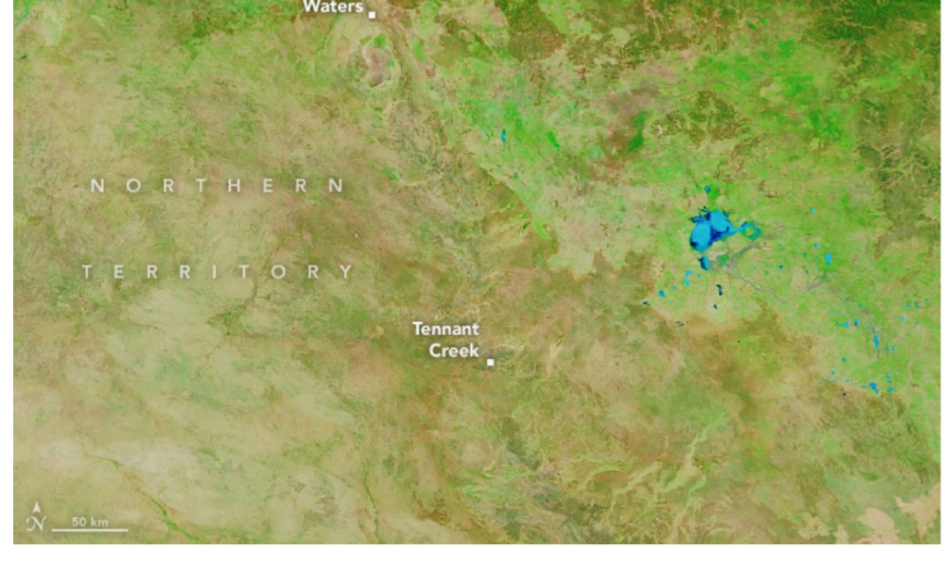
Swollen rivers and lakes are visible in the Barkly region near Tennant Creek and Newcastle Waters in this false-color satellite image (right).
The image was acquired on March 10, 2023, with the Moderate Resolution Imaging Spectroradiometer (MODIS) on NASA’s Terra satellite. Water appears light to dark blue. Vegetation is green and bare land is brown. For comparison, the MODIS image from the Aqua satellite (left) shows the same area on March 5, 2022, during drier times.
According to news reports, floods swamped cattle pastures, roads, and homes in the remote region.
Farther north and west in the more densely populated Victoria Daly and Roper Gulf regions, floodwaters inundated entire towns, blocked key roads and rail lines, and disrupted food supplies. Daguragu, Kalkarindji, Pigeon Hole, and Palumpa are among the towns that had to be evacuated.


NASA Observatory images by Lauren Dauphin, using MODIS data from NASA EOSDIS LANCE and GIBS/Worldview. Story by Adam Voiland.
Source, NASA.

